.
“The only way to learn is … to go and see,” declares Von Hardwigg, hero of the 1864 seminal subterranean science fiction novel, Journey to the Centre of the Earth, as he prepares for a bold expedition into a volcano to investigate the Earth’s depths.
Some places on Earth are hard to get to — travel may be difficult, expensive or dangerous. But advances in scientific tools mean that studying the Earth’s depths doesn’t require scientists to physically “go and see” so often. Modern satellite radar methods enable even tiny changes to be noted, quite quickly, from afar.
“Now we can observe the entire globe without traveling into the area, which is very important for improving our observation capability,” says geophysicist Sigurjón Jónsson. “For example, at the moment we are studying Syria,” which is currently too dangerous to visit.
Jónsson studies big hazards, earthquakes and volcanoes, which involves studying precise changes in geological structures. For volcanos, he explains, this includes monitoring deformation, or how the ground “inflates,” which is often the first sign of a volcano entering an active phase. Or for earthquakes, where the plate boundary has “jumped.”
The satellite data is collected as radar scans by several space agencies and licensed for download as large data sets. Jónsson’s work uses data from many satellites but relies mostly on data from the European Space Agency’s Sentinel-1A and Sentinel-1B satellites. “When we study an area, we typically collect all the data we can get. Then, we can process these big data sets and produce colorful images that are like contours of deformation,” Jónsson says. “From these, we can sometimes infer exactly where an earthquake happened.”
“Now we can observe the entire globe without traveling into the area, which is very important for improving our observation capability.”
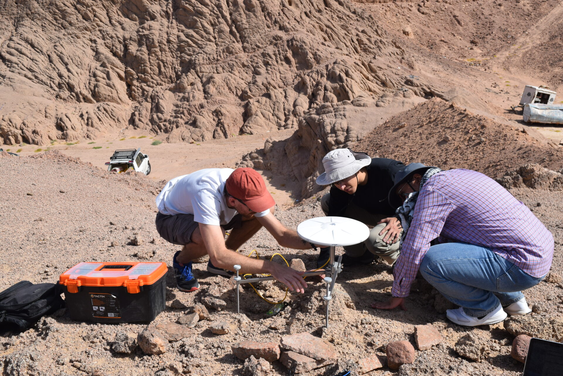
To complement the satellite data, Jónsson’s team does get “to go and see” in the field. “Fieldwork inspires our work in the office,” Jónsson explains. So, for a few weeks each year, the scientists visit far flung places — including Iceland, Northern Saudi Arabia and sometimes Eritrea — where the students get exposed to the elements and the challenges of collecting field data.
An important field site for Jónsson’s team is the Gulf of Aqaba, which he describes as having spectacular scenery with beautiful mountain ranges that rise vertically out of the sea. These also provide a clue that there is something geologically interesting going on. The dramatic 4 kilometer relief — from 2000-meter-deep sea offshore to 2000-meter-high mountains— is a sign of very active tectonics, he says.
“Gulf of Aqaba is really a boundary between two plates,” he explains. “It’s between the Arabian plate that is moving northward with respect to the Sinai plate to the West. Because it’s moving about 5 millimeters per year, from time to time the normally stuck boundary jumps, and we have a big earthquake.”
This field research helps refine the methodology for the earthquake hazard discipline, but it also provides compelling findings for the region, and for the nation. Bold development giga projects for Saudi Arabia include the construction of the futuristic city NEOM near the Gulf. “While more work is needed to fully understand the earthquake hazards for this new city NEOM, our current work in this area shows the hazard may be somewhat lower than previously thought, but it is still significant and needs to be considered in infrastructure designs,” Jónsson says.
Also planned for the region is a new crossing across the Gulf of Aqaba to Egypt, near the city of Sharm El-Sheikh. “This is a tricky project because you go right across this plate boundary fault, which can generate large earthquakes, and that would need to be considered when engineering such a crossing.”
“the hazard may be somewhat lower than previously thought, but it is still significant and needs to be considered in infrastructure designs”
Although this area of the Middle East has limited historical information about past earthquake activity, there was a large earthquake in 1995 of a magnitude of 7.2, known as the Gulf of Aqaba or Nuweiba Earthquake. This occurred in a sparsely populated area, but there were still 11 deaths, around 50 injured and much damage to infrastructure.
Coincidentally, just a few months later in 1996, young Jónsson traveled through the area on a holiday with some friends — oblivious to the recent earthquake, and unaware that during his future career he would be studying the movement of those plates beneath his feet.